


JTG-1 FIBER OPTIC NORTH-FINDER GYRO INCLINOMETER


2 sold in last 9 hours
Hurry! Over 17 people have this in their carts
Brand: GOLD
Product Features:
- Multi-shot surveying – captures multiple orientation points in a single run, enabling detailed trajectory mapping deviation analysis.
Estimated Delivery: Mon, Jul 20 – Mon, Jul 27 (Excl Sat, Sun)
... people are viewing this right now
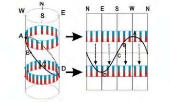
The Fiber-Optic North Finder Gyro Inclinometer is a non-magnetic borehole survey instrument ideal for accurate azimuth and inclination measurements in environments where magnetic interference is a major concern.
It is powered by advanced fiber-optic gyroscope (FOG) technology. It ensures reliable orientation data in iron casing wells, deep boreholes, and complex geological settings.
Applications
- Mineral exploration and resource delineation
- Oil, gas, and geothermal directional drilling
- Geotechnical and civil engineering surveys
- Tunnel and underground infrastructure monitoring
Related Products

Brand: GOLD
GDQ-2D DIGITAL INCLINOMETER
Product Features:
- Digital Accuracy – captures real-time inclination and azimuth readings with high resolution and stability.
- Non-magnetic compatibility – Ideal for use in formations where magnetic interference compromises traditional compass-based tools.
- Portable and Field ready – Lightweight, rugged design with intuitive interface for rapid deployment in remote or challenging terrain.
- Multi-drilling adaptability – suitable for hydrological, geothermal, mineral exploration, and geotechnical boreholes.
- Data Logging and transfer – Integrated memory and USB connectivity for seamless data export and post-processing.


Brand: GOLD
DJ SERIES LOGGING WINCH
Product Features:
- AC variable-Frequency Regulating Speed Technology that enables precise control of cable deployment, and retrieval.
- Dual mode Operation: Allows users to choose between automatic constant speed for consistent logging and manual speed control for operator flexibility.
- Intelligent depth management for automatic depth calculation:This enables real time tracking of probe position to ensure accuracy.
- Enhanced safety and control. It has a self-locking brake system that secures probe position during emergencies or pauses.


Brand: GOLD
GDP-3D WIRELESS DIGITAL INCLINOMETER
Key Features
- Wireless and Bluetooth connectivity – enables seamless data transmission and real-time monitoring without cumbersome cables, enhancing field efficiency and safety.
- 3D orientation sensing – equipped with three magnetometers and three accelerometers for full spatial awareness and high-resolution directional data.
- Magnetic multi-shot surveying – captures multiple orientation points in a single run, ideal for complex borehole trajectories.
- High precision and stability – it is engineered for consistent performance in non-magnetic and weak magnetic formations, minimizing distortion and drift.
- Portable and user-friendly – It has a compact design and an intuitive interface suitable for varied field conditions and rapid deployment.

Brand: GOLD
GD-C1201 FULL HOLE IMAGING SYSTEM
Product Features:
- Panoramic borehole imaging that captures continuous, full circumferences images of the borehole walls revealing bedding planes, fractures, lithological contacts, and structural features with exceptional details.
- Digital video and still capture offering both real time video streaming and high-resolution still image recording for post analysis and reporting.
- Depth-synchronized logging that authentically correlates image data with precise depth measurements for accurate geological interpretation.
- Robust downhole camera suited for high temperature, high pressure, and corrosion.

Brand: GOLD
GDQ-2D GEOPHYSICAL BOREHOLE LOGGING EQUIPMENT
Product Features:
- High resolution sensors for resistivity, seismic, IP, and magnetic measurements.
- Borehole cameras and loggers for visual inspection and structural analysis
- Modular design compatible with various probe types and depths
- Rugged construction for field reliability in harsh environments
- Intuitive design software for data visualization, interpretation, and reporting


Brand: GOLD
GYGD-V PUSH ROD INSPECTION CAMERA
Product Features:
- High resolution camera head for detailed visuals.
- Flexible push rod system allowing navigation through narrow and curved pipes.
- Waterproof and corrosion resistant ensuring reliable performance in tough conditions.
- Real-time video and image capture
- Distance counter and depth indicator that tracks insertion length for accurate location mapping